Introduction to
Electronic Chart Navigation

by David Burch

A comprehensive guide to electronic chart navigation using vector charts, including an annotated list of ECDIS chart symbols.
ENC Essentials
by David Burch

A short guide to a quick start use of electronic navigational charts
Electronic Chart Symbols
A compilation of nautical chart symbols used on electronic navigational charts (ENC).
GPS Backup with a Mark 3 Sextant
By David Burch

No power? Batteries used up? This book and a Mark 3 sextant lets you carry on.
Stark Tables for Clearing the Lunar Distance
by Bruce Stark

Find GMT from sextant sights and become an expert at cel nav in doing so.
Long Term Almanac
by Dr. Geoffrey Kolbe

Nautical Almanac data for sun and stars valid till 2050
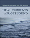
Tidal Currents of Puget Sound
by NOAA, University of WA Dept. of Oceanography,
and WA Sea Grant

Current Charts plus Tide Prints of Puget Sound.
Mariners Pressure Atlas
Worldwide Mean Sea Level Pressures and Standard Deviations for Weather Analysis and Tropical Storm Warning.
1981 Nautical Almanac
1981 Nautical Almananc for use with USCG celestial navigation exam problems.
Sailors Logbook
Ideal logbook for day sails or ocean passages, racing or cruising.
The Barometer Handbook
by David Burch

An in-depth look at barometers and applications of barometric pressure.
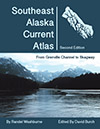
Southeast Alaska Current Atlas
by Randel Washburne

The charts in this atlas show scaled arrows marking current speeds and directions at each of the official stations at sequential hours.
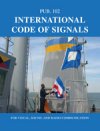
Pub. 102, International Code of Signals
Covers visual, sound, and radio communications.
Sea State Forecasting ebooks
Three classic texts on waves, swells, and sea state forcasting. Long out of print, but still very valuable.
Nav Rules Flash Cards
A great way to study the Nav Rules.
Sight Reduction Tables
Pub. 229, Pub. 249 and NAO Tables available.
Farwell's Rules of the Nautical Road
by Craig H. Allen, Jr and Sr.

Most important guide to the most important book in Navigation
The Navigation Rules,
US Inland and International Waters

The official USCG wording, publication COMDTINST MI6672.2D.
Nautical Almanac
Annual list of star and planet locations plus other data needed for celestial navigation.
Oceanography and Seamanship
by William G. Van Dorn

Covers winds, waves, currents, stability, and more.
Chart No.1
Nautical Chart Symbols and Abbreviations

13th edition, April 15th, 2019.


8/21/25 
celestialweathernavigationmiscellaneousreferenceall booksebooks
|| home || books index || order help || view shopping cart ||


home order help