 |
 |
|||||
|
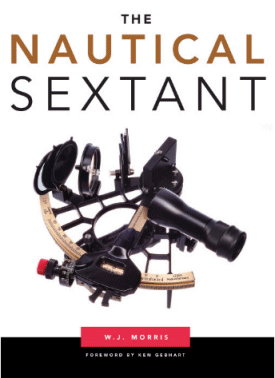
The Nautical Sextant by WJ Morris
A rare and valuable look into the details of how sextants work.
Hardback book, many excellent color photos, 246 pages $39.95 ...item# 1827
|
 |
|
Author's description of the book:
"Every book that covers celestial navigation gives some sort of description of the sextant and usually plenty about its use. However, of the few books published in the twentieth century, specifically about the sextant, none give much detail about the structure of the sextant. The Nautical Sextant, published originally in an e-book as “The Naked Nautical Sextant,” aims to correct this. You will find little in it about how to use the sextant, but you will find a wealth of detail, down to the nuts, bolts and washer level, about its structure, with clear instructions about its maintenance, repair and adjustment that you cannot find anywhere else. It covers instruments from about 1850 to the present day, so the collector and antique enthusiast is well-catered-for. Though little used now by the professional sailor, the sextant has enjoyed something of a renaissance among recreational sailors, and at least 2000 new sextants are being produced annually to cater for this demand This is no mere pamphlet, but a substantial work of over 66,000 words containing over 270 labeled colour photographs and diagrams in over 250 pages. -- WJ Morris |
|