 |
 |
|||||
For use with Starpath Inland and Coastal Navigation course
|
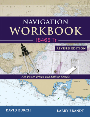
Training Chart 18465 Tr
Chart 18465 Tr Training Chart $11.95 ...item# 1823
|
 |
||||||
|
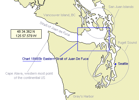
Chart no 18465 Tr is identical to the 1995 edition of chart 18465, Eastern Strait of Juan de Fuca. It is just locked in time so schools can build practice problems using its nav aids and know they will not change. The image above shows the region that this training chart represents.
Note that all traditional paper charts like this one have been permanently discontinued, now replaced by electronic navigational charts (ENC). However, NOAA now offers a way for users to create their own supplementary paper charts called NOAA Custom Charts (NCC). The NCC are based on the ENC, but NOAA makes these using the old traditional paper chart symbols. This means we can still use this training chart to teach how you will read and plot on the new NCC. The chart is shipped folded in order to lower shipping costs, and it will most likely be folded eventually anyway. If you care to see the entire chart online, see the options listed in our Navigation Workbook: 18465 Tr support page. If you can get by with an echart, then that support page also offers several options at no charge. Our full set of workbooks:
|
|||||||